
talking history | syllabi | students | teachers | puzzle | about us
David Rumsey Map Collection
http://www.davidrumsey.com/
Created and maintained by Cartography Associates in partnership with Luna Imaging, Inc.
Last site update Dec. 15, 2001. Reviewed June 2230, 2002.
Maps are remarkable examples of material culture. As texts, they provide historians rich views of how people compiled data about their world and thus how they perceived geography and spatial relationships. Maps also affect peoples' geographical decision making, encouraging them to make significant choices, for instance, in establishing transportation routes or fighting battles. Like historical documents of any kind, however, few maps are widely available, and few collections are both adequately comprehensive and generally accessible. The David Rumsey Map Collection has moved to correct the situation by allowing scholars to research a large collection of maps without the need for travel to collections.
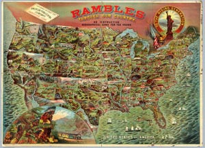
This idiosyncratic Web-based collection-some 6,400 items-includes less than 5 percent of David Rumsey’s total map collection, and, although running behind his initial ambitious schedule, Rumsey is moving quickly to mount more maps every year. Both the larger collection and the Web portion of it focus heavily on nineteenth-century American atlases and school geographies and so thematically map document development of economic, political, and population patterns, the common topics of such atlases.
Page design is striking and effective, and the interface, with split screens for maintaining work space while querying the collection, is very usable. Indeed, the design enhances the utility of the collection by allowing the user much closer inspection of map detail than would be the case in a cartobibliography, where illustrations are highly limited; in an atlas of historical maps, where selection is commonly limited and characteristically biased; or in an actual collection, where preservation requirements limit how much one can touch, let alone manipulate, maps for analysis.
Digital maps by definition require large, high-resolution image files. The site houses three browsers of increasing sophistication and with zoom functions to access the collection. Luna Imaging developed two, one for general searching and one with a downloadable Java client for enhanced research. The third is a GIS (geographic information systems) browser that allows a researcher to overlay selected content with current geospatial data. The page also allows one to create slides for noncommercial use. The site received the 2002 Webby Award in Technical Achievement.
The collection does not have the thematic coherence of a good scholarly atlas of historical maps, nor does it have the extensive cross-referenced bibliographic information of a good cartobibliography. I queried the browser for “railroads,” and it listed with illustration 153 maps; for Maine, it listed with illustration 33 maps. It found none for “John Melish,” an early-nineteenth-century geographer and cartographer, but I found several Melish maps when I queried “1816,” the date of one of his atlases. The scholarly utility of the collection will grow as more maps are added and cross-cataloging improves. For now, it remains more an antiquarian collection than a truly scholarly one, reflecting David Rumseys own intellectual and aesthetic tastes and collecting habits. But it has wonderful maps that are well presented and accessible, and it deserves regular visits.
Joseph S. Wood
University of Southern Maine
Portland, Maine