This is an archived copy of History Matters, provided by the Roy Rosenzweig Center for History and New Media. To explore this content in a new interface, visit Who Built America?.

 |
When reading in a foreign language, you may need to consult a dictionary to fully understand what has been written. When reading a map, you need to understand its symbolism. The following items are a checklist to be used in helping you translate maps. Title -- Like a newspaper headline, the title of a map should tell the reader "what," "where," and "when" about the map. The date should help the reader fit the map into its proper chronological niche. Note: the date in the title may not be the date the map was constructed. Orientation -- By convention, cartographers place North at the top of maps. If there is a deviation from that practice, the map should have a compass rose or some other symbol to help orient the user. Scale -- The map scale should be shown so that the reader can make judgments about distances. Graphic scales are an absolute must when dealing with maps as computer images or printing images from digital sources. Ratio and written scales are virtually meaningless in this medium. Legend -- There must be a key that explains the symbols used by the cartographer. To visualize reality the map reader needs to be able to convert various shapes, colors, and textures into the phenomena they represent. Grid -- The map needs to have a coordinate system, in the form of parallels of latitude and meridians of longitude, so that the area can be placed in its proper geographic location on the globe.
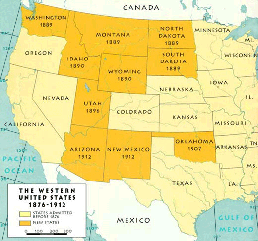
Which element is missing?
|
|||
 |
||||