talking history | syllabi | students | teachers | puzzle | about us
Sanborn® Fire Insurance Maps for Georgia Towns and Cities, 1884–1922
http://dlg.galileo.usg.edu/sanborn/
Digital Library of Georgia as part of Georgia HomePLACE.
Reviewed Sept.–Oct. 2007.
Sanborn® Fire Insurance Maps, Utah
http://www.lib.utah.edu/digital/collections/sanborn/
University of Utah’s J. Willard Marriott Library.
Reviewed Sept.–Oct. 2007.
Sanborn® Fire Insurance Maps of South Carolina
http://www.sc.edu/library/digital/collections/sanborn.html
South Caroliniana Library as a part of the Digital Collections of the University of South Carolina.
Reviewed Sept.–Oct. 2007.
Digital Sanborn Maps, 1867–1970 (access by subscription)
http://sanborn.umi.com/
ProQuest. Digital Sanborn Maps are reproduced and distributed under exclusive license from Environmental Data Resources, Inc.
Reviewed Oct. 2007.
Arguably one of the most effective sources for traditional and public historians alike, Sanborn fire insurance maps offer unparalleled documentation of over a century of urban development and land use in the United States. The brainchild of the surveyor Daniel Alfred Sanborn, Sanborn fire insurance maps originated in 1867 as a means to establish insurance costs for protecting the burgeoning numbers of cities and towns against the threat of fire. In the Sanborn Map Company’s effort to reflect property values accurately, it established the first nationally standardized mapping techniques, which included documenting the location, use, and construction materials used in buildings in cities and towns across the country. By World War II, the company had produced surveys of 13,000 towns, resulting in more than 700,000 sheets. Through its periodic resurveying of towns and cities, the Sanborn Map Company effectively tracked physical change over time, creating a gold mine of information important to historians, urban planners, environmentalists, geographers, architects, and others.
Until recently, most researchers had to rely either on copies of cumbersome, oversized original maps bound by their respective years of issue or on microfilmed copies that came with their own challenges when browsing and copying. Thanks to the maps' digitization and placement on the World Wide Web, the public will enjoy heightened access to these unique resources. Frequently, Web sites offering digital Sanborn maps are gated; however, a number of university libraries that hold secondary copies from the Library of Congress’s Geography and Map Collection Division offer unimpeded access in a variety of formats and are easily accessible from any search engine. Reviews of three of such sites, and one gated site, illustrate the divergent ways researchers can use the Sanborn maps.
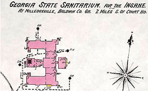
Fire insurance map for the Georgia State Sanitarium.

Detail of a Sanborn map from Utah.
Launched in 2001, Sanborn® Fire Insurance Maps, Utah, is comprised of maps from various towns and cities throughout Utah. The site allows the navigator to search or browse the J. Willard Marriott Library’s collection of approximately 1,300 digitized color Sanborn maps. Browsing is organized by city and the year the map was created; by choosing a specific city, the corresponding maps by year are made accessible. Once a selection has been made, a list of individual maps appears by sheet number, including the index page. That these maps are not listed in order is a flaw that should be addressed. The key is also not hyperlinked with the individual pages. Consequently, instead of being able to click on the page within the index image, users must back up and search for the sheet from the list. Users can zoom in on individual areas of the maps as well as pan around at various levels of magnification. Also, once selected, individual maps feature listings of metadata, which allows for easy referencing. While very useful, the Web site could be improved with the addition of information such as how many maps the collection holds and the history of the maps' acquisition (facts currently available only at a related site). Navigation could be enhanced by allowing users a way to better move around from map to map.

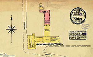
Detail of a Sanborn map of the Highland Park Hotel in Aiken, South Carolina, 1884.
Sanborn® Fire Insurance Maps of South Carolina features “over 4,600 sheets covering 97 South Carolina towns and cities from 1884 to the 1960s.” The South Caroliniana Library at the University of South Carolina houses these maps and was responsible for this digitization project, launched in 2005. The collection also houses numerous rare, unpublished maps from South Carolina acquired from an insurance company that is now out of business. This collection does have some search restrictions, however. The navigation options are similar to those of the University of Utah’s site, but the South Carolina site has additional search enhancements. A researcher can search by keyword or browse by city, year, or county. Like on the Utah site, the individual maps are not hyperlinked to the index page. Fortunately, the individual maps are listed on the left side of the screen, so researchers can quickly navigate to the map they wish to see. Once the map is chosen, zooming allows for a better perspective on what the maps contain. Because the maps are frequently used to obtain building information for National Register of Historic Places nominations, the home page has a link to the South Carolina State Historic Preservation Office. The site also links to South Carolina’s statewide survey of historic properties and to the University of California, Berkeley’s, Union List of Sanborn and Other Fire Insurance Maps (by Philip Hoehn, http://www.lib.berkeley.edu/EART/sanbul.html), which provides a state-by-state list of all the available fire insurance maps by municipality and indicates if they are available online. And, like its University of Utah counterpart, the University of South Carolina’s site features an in-depth explanation of the structure of the digitization project.

Section of a Sanborn map insurance map of Alexandria, Virginia from 1902.
In 2001, ProQuest launched Digital Sanborn Maps, 1867–1970. This gated Web site grants access to over 660,000 Sanborn maps representing over 12,000 cities and towns. The drop-down lists make navigation easy, and once researchers have found a map, they can simply click on the image to activate the panning and zooming functions. If a researcher is unfamiliar with the layout of the city or town being investigated, index sheets allow for quick referencing. The sheer volume of maps offered by this service is mind-boggling, and the most recent maps that the Sanborn Company rendered are available, thanks to a licensing agreement between ProQuest and Environmental Data Re sources, which owns the reproduction rights to Sanborn maps outside the public domain. Unfortunately, a crucial element to the success of Sanborn maps—their color—is missing because the entire collection was scanned from microfilm masters. Despite the inclusion of a key developed by the Sanborn Map Company for use on black-and-white versions of its maps, the lack of color considerably undercuts the utility of these maps; researchers cannot readily recognize building and land-use trends through color codes denoting the composition of building materials. For historians hoping to use excerpts of maps for compelling publication or exhibit purposes, the lack of color may prove a substantial obstacle. However, for the vast majority of researchers, this issue may pale in comparison to the materials made available to them, albeit for the price of admission.
Thanks to the digital age, a most useful and comprehensive research source is now available to countless researchers who will visit and revisit the Sanborn Map Company’s century-long endeavor to conceive, execute, and maintain a reliable resource that documents the nation’s ever-evolving towns and cityscapes.
John M. Sherrer and Helena Ferguson
Historic Columbia Foundation
Columbia, South Carolina
